The Relief of Morocco
Among the Maghreb countries, Morocco stands out for its diverse topography, which includes high mountains, extensive plains, and arid plateaus.
1.1. The Rif
Located in the extreme north, the Rif features a complex alpine-like structure. This mountain range, relatively low with altitudes generally below 2,000 meters, is characterized by limestone and sandstone formations. The Rif descends steeply toward the Mediterranean, creating rugged landscapes shaped by intense erosion.
1.2. The Central Plateau
To the north of the mountains, there are low-altitude plains and plateaus open to the Atlantic and the Mediterranean. The Central Plateau, or Oulmès Massif, rises to over 1,600 meters and includes high plateau areas such as the Moroccan Meseta and sedimentary plateaus. These regions are favorable for agriculture due to their Mediterranean climate.
1.3. The Atlas Mountains
The Atlas mountain ranges, in the center of the country, include the Middle Atlas, Anti-Atlas, and High Atlas.
The Middle Atlas: Composed of limestone mountains oriented southwest/northeast, the Middle Atlas is surrounded by high plateaus like the Middle Atlas Causses. It features Jurassic and volcanic aspects, with altitudes reaching up to 3,354 meters (Bou Naceur).
The Anti-Atlas: Located in the southern part of the country, the Anti-Atlas is an ancient massif mainly made up of quartzites, sandstones, and limestones. Its highest peak is Djebel Siroua at 2,531 meters.
The High Atlas: An imposing range extending 700 km from southwest to northeast, the High Atlas includes many peaks exceeding 3,000 meters, including Toubkal at 4,165 meters, the highest peak in North Africa. This mountain range is known for its deep valleys and spectacular landscapes.
1.4. The Moroccan Sahara
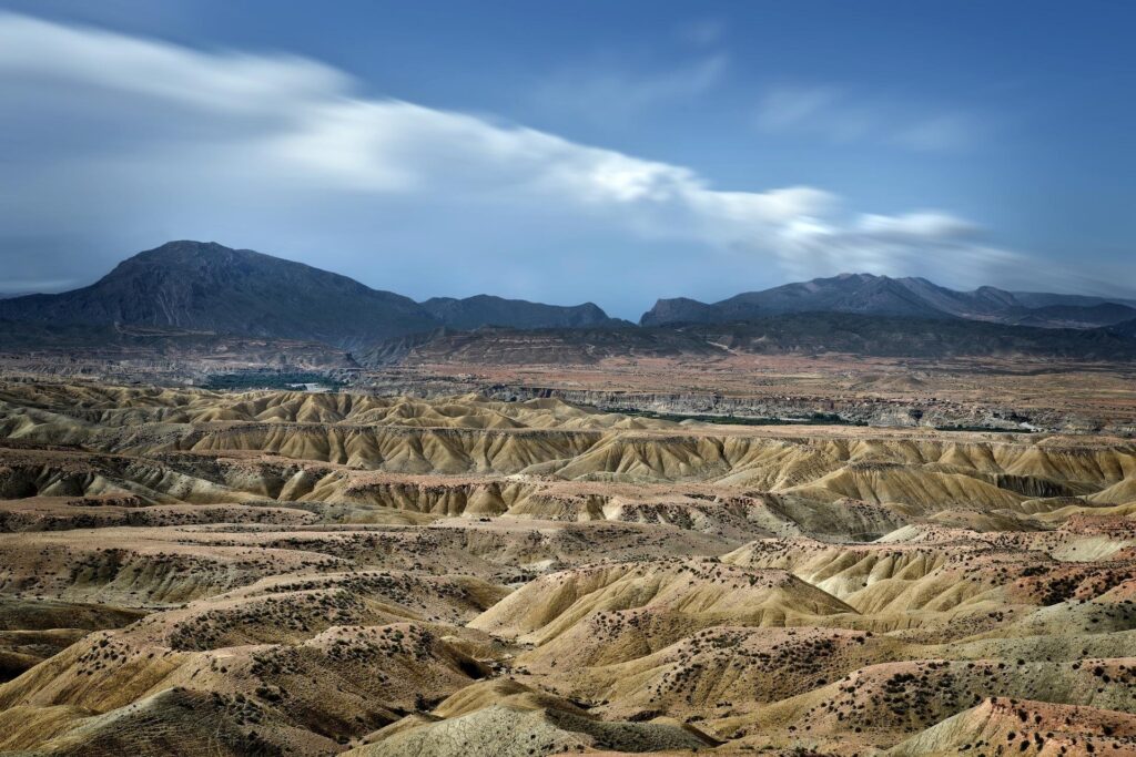
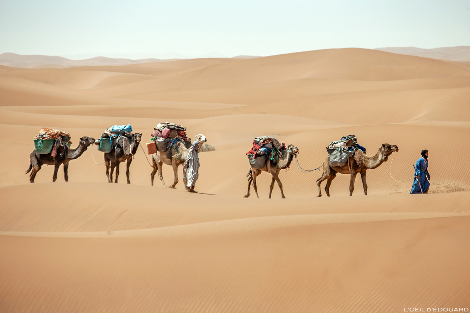
To the south of the mountains lies the Moroccan Sahara, characterized by vast stretches of stony hamadas and a few oases such as those of the Draa River and Tafilalet. This region is arid, with rare precipitation and vegetation adapted to drought.
The Climate of Morocco
Morocco benefits from a variety of climatic zones due to its geographic location and topography.
Mediterranean Climate: Present in the northern part of the country, this climate is characterized by mild, wet winters and hot, dry summers. Precipitation ranges from 200 mm to 800 mm annually, with possible snowfall in the mountains.
Dry Subtropical Climate: Found in the southern part of the country, this climate is more arid with precipitation less than 100 mm per year. It is typical of desert areas like hamadas and regs.
Bioclimatic Zones of Morocco
The bioclimatic zones of Morocco vary based on summer aridity and precipitation:
Humid Zone: In the north, with rainfall exceeding 800 mm, this zone is home to cedar and oak forests.
Subhumid Zone: With 800 to 500 mm of precipitation, this zone includes the Atlantic plains where dry cereal farming occurs.
Semi-arid Zone: With 500 to 100 mm of precipitation, this zone features agriculture that depends on variable climatic conditions.
Arid Zone: With less than 100 mm of precipitation annually, primarily in the south, this is the domain of deserts and sandy expanses.
The Hydrography of Morocco
Morocco has significant water resources due to its mountainous terrain. Major rivers include the Moulouya, Sebou, Bou Regreg, Oum er-Rebia, Tensift, and Sous, which are used for irrigation and electricity production through the construction of dams.


2 Comments
Duanealtes
Этот сайт собирает важные информационные статьи разных сфер.
Здесь вы легко найдёте новости о политике, культуре и разнообразных темах.
Новостная лента обновляется в режиме реального времени, что позволяет следить за происходящим.
Минималистичный дизайн помогает быстро ориентироваться.
https://nbcollector.ru
Все публикации оформлены качественно.
Целью сайта является достоверности.
Присоединяйтесь к читателям, чтобы быть в курсе самых главных событий.
Duanealtes
Данный портал публикует свежие новости на любые темы.
Здесь можно найти события из жизни, бизнесе и разных направлениях.
Материалы выходят регулярно, что позволяет всегда быть в курсе.
Простой интерфейс облегчает восприятие.
https://ullafashion.ru
Любой материал предлагаются с фактчеком.
Мы стремимся к объективности.
Присоединяйтесь к читателям, чтобы быть в курсе самых главных событий.